Hazards live now
The ground moving, as it happens
Earthquakes within a minute of detection, satellite fire detections, tropical cyclones with forecast cones and wind swaths, global disaster alerts and WHO outbreak notices.
Open situational awareness
Vigil fuses public feeds into a single real-time map. Hazards, movers, cameras, conflict and infrastructure, on one canvas, with the freshness of every source in plain sight.
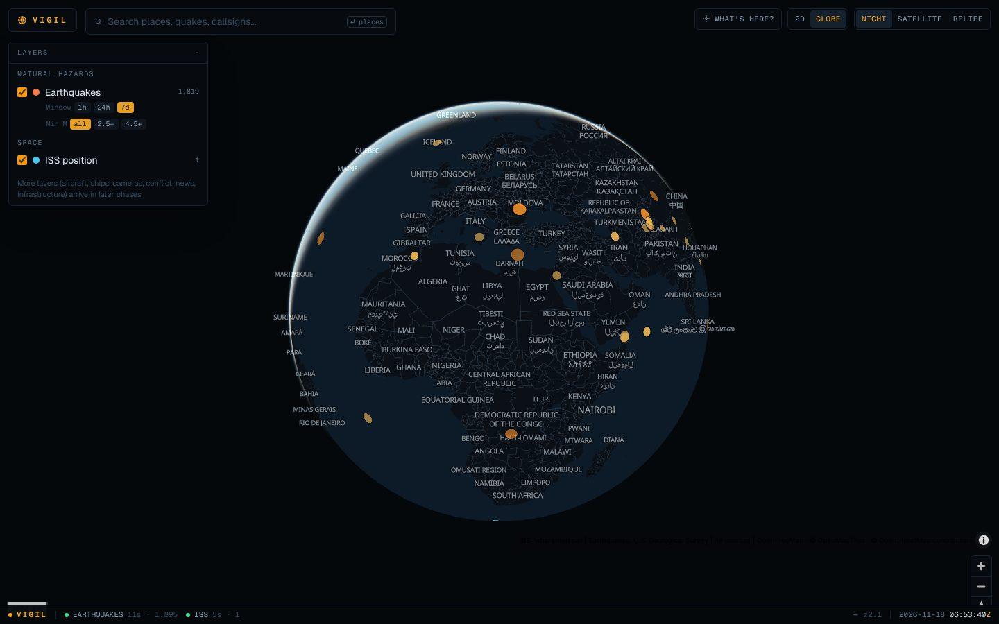
A flat map and a 3D globe share the same engine. Flip between them without losing your place.
Click anywhere with “What’s here?” to list every feature nearby, across every layer — even ones you have switched off.
Every feed reports its last success, last error and record count. The status bar never hides a stale source.
Only feeds published for public use. Every source, licence and refresh rate is documented on the sources page.
Layers
We say plainly what works today and what is still being built.
Earthquakes within a minute of detection, satellite fire detections, tropical cyclones with forecast cones and wind swaths, global disaster alerts and WHO outbreak notices.
The International Space Station's live ground position, refreshed every few seconds.
ADS-B aircraft with emergency squawks, military flags and trails; AIS vessels with went-dark detection and sanctions matching against the OFAC list.
Over 10,000 public cameras from transport agencies in North America, Europe and Asia-Pacific — live video where offered, favourites and a camera wall.
Geocoded crisis coverage every 15 minutes, scored for severity, rolled up into a hexagonal risk surface, with country briefs.
Power plants, airports, ports and dams from openly licensed global datasets.
FAQ
Yes. It runs on public, openly licensed feeds and free basemap tiles. Some upstreams require a free API key, which the operator configures on the server.
Each layer refreshes on its own schedule — seconds for the ISS, a minute for earthquakes. The status bar shows exactly how old each feed is. When an upstream fails, the last good data stays on the map and is marked stale.
No. The map never asks for your location. Searches are proxied to the geocoder without identifying you, cached briefly in memory to respect its rate limits, and never stored or logged. Map preferences live only in your browser’s local storage.
USGS, OpenStreetMap, OpenFreeMap and other public sources — each listed with its licence and attribution on the sources page. Our servers fetch and cache every feed; your browser never talks to a third-party data API directly.
Yes, it runs in any modern browser with WebGL. A large screen is best for the multi-layer view.
No. Vigil aggregates public data for awareness. For decisions that matter — safety, travel, emergencies — follow the originating agency and local authorities.